
Frost shattering
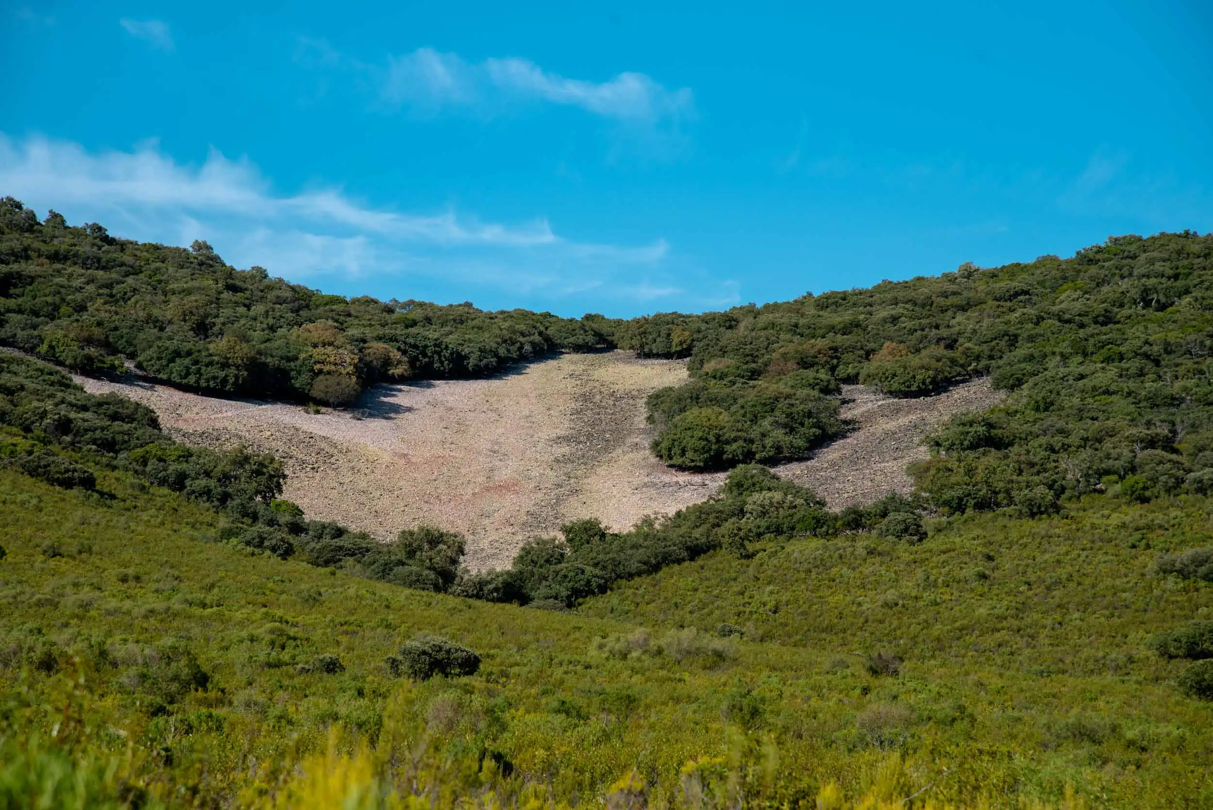
Water gets into a crack, freezes, takes up more space and opens it. This is how the screes of the mountains were made.
Cabañeros National Park
How the floor of a sea became quartzite mountains and raña plains, told from the rock up.
Start with the rock10 chapters with drawings · 23 more minutes if you open the full texts
1What it is for
Geology studies what the Earth is made of and how it has changed. Here it matters for one reason: it explains why each corner of Cabañeros grows what it grows.
Quartzite is hard and lasts; slate is soft and crumbles.
Soil comes from crumbled rock: thin on the ridges, deep in the valleys.
Each plant grows where soil and water are enough for it.
And each animal lives where its food is.
Geology is a natural science that studies the composition and structure of the Earth and how it has evolved over time. The first geological observations were made in ancient Greece by Hesiod, Thales of Miletus, Anaximander and Pythagoras. Hence its name: geo- = earth; logy = treatise, study, science. Besides analysing the particularities of the Earth, today geology is of great help to human activities such as the extraction of mineral or energy resources, or to predict natural hazards and disasters. But not only that: geology gives us historical clues to environmental change, the keys to biodiversity and the evolution of human life since prehistory.
This last idea is the one that interests us and the one we will analyse to understand how the plant and animal richness of Cabañeros has been shaped, since geological processes have influenced it decisively.
2Time
The history of the Earth is divided into four eons: Hadean, Archean, Proterozoic and Phanerozoic.1 Cabañeros begins to write its own story almost at the end, in the last one.
If the Earth's 4,567 million years were 24 hours,2 each hour would be about 190 million years.
The last three hours, under a magnifying glass
First of all, you should know that geological history is divided, to begin with, into four eons: Hadean, Archaean, Proterozoic and Phanerozoic. The first three are usually grouped under a single supereon called the Precambrian.
Cabañeros National Park begins its geological journey at the end of the Proterozoic and the start of the Phanerozoic, more than about 500 million years ago, when the Earth was joined in a single continent called Pangaea.

Cabañeros National Park has developed its geological history during the Phanerozoic, that is, in the last 541 million years. To give you an idea, look at the following chronological clock. Cabañeros begins in the Palaeozoic, the first of the three eras of the Phanerozoic.

As you can see in the following table, the changes during the Phanerozoic are more constant, which is why it has been divided into periods, epochs and ages. The table is read from right to left, that is, the oldest epoch corresponds to the Precambrian.

3Layers and plates
By what it is made of, the Earth has three layers; by how it behaves, five. And the outer one is broken into plates that move and collide.
The outer layers are drawn thicker than they are, so that you can see them.
What is hot rises and what cools sinks: this coming and going in the mantle drags the plates along, and where they collide the ground is pushed up.
In this way, between 60 and 25 million years ago, the collision of Iberia with the rest of Europe raised the Pyrenees and, along the way, the Sistema Central, the Cantabrian Mountains and the Montes de Toledo.9
The Earth has 3 layers.
As you go deeper into the Earth, temperature, pressure and density rise. According to these parameters, there are 5 layers. We start from the outside.

The lithosphere is divided into rigid plates that “float” on the partly molten parts of the asthenosphere. These plates move and collide, why? Because of changes in temperature and gravity. Let me explain: when a material cools, it gains density and therefore tends to sink. When this happens, the Earth’s crust rises. This is how ranges and mountains are born.
On this website you can see the evolution of the Earth.4Rocks
Magma cools and becomes rock, the rock wears away, the pieces pile up and are pressed together and, if they sink deep enough, they melt again. It is a cycle that never stops.
Magma. Rock melted by the heat inside the Earth. It is lighter, so it rises.

Igneous rock. Magma that cools: inside the Earth (plutonic, like granite) or when it comes out of a volcano (volcanic).
Sediments. Rain, wind and ice break the rock. Rivers carry the pieces to the basins.

Sedimentary rock. Layers of sand or mud that are pressed and stuck together. In Cabañeros almost everything began like this, on the sea floor.

Metamorphic rock. Rock that is transformed without melting, by pressure and heat. Sandstone becomes quartzite.
In the open air, rocks are altered: they split (physical weathering) or change their composition (chemical weathering). Soils come from this crumbling.
Water gets into a crack, freezes, takes up more space and opens it. This is how the screes of the mountains were made.
The heat of the day and the cold of the night make it expand and shrink until it cracks.
Water evaporates, the salt crystallises and grows inside until it breaks the rock.
Getting wet and drying out, again and again.
Rock that was buried and cracks when the weight above it is removed.
And the chemical kind: OxidationDissolutionCarbonationHydrationHydrolysisBiochemicalLaterisation
The rock cycle is constant and circular. When rocks melt because of changes in temperature inside the Earth, they turn into magma. This, less dense, rises to the surface and cools, giving rise to rocks that will undergo changes due to erosion. The eroded particles are carried by rivers or wind, among other factors, to flat areas such as sedimentary basins, where this accumulation will form sedimentary rocks.
Some of the sedimentary rocks sink, increasing their pressure and temperature. This excess heat produces liquid rock, that is, magma, which, through the same process as before, is expelled to the surface (volcanoes).
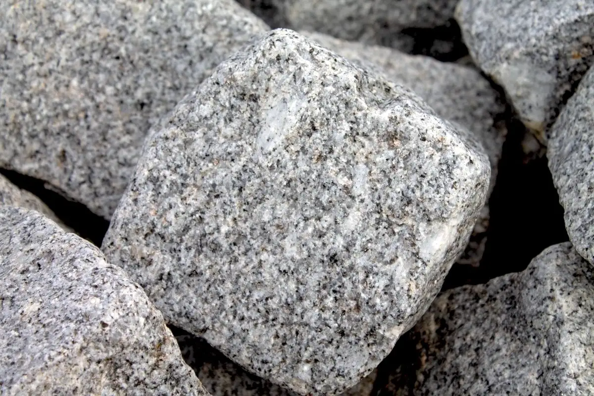


Rocks are eroded by contact with the atmosphere: rain, wind and so on. As they break down, rocks change. This process is called weathering and can be chemical, physical or biological, in order to reach a balance with environmental conditions. This breaking up of the components of rocks is what forms soils and regoliths (a layer of unconsolidated materials).

5Soil
Soil is crumbled rock mixed with remains of plants and animals, water and air. It forms in layers, called horizons, and the wetter the climate, the thicker it is.
What decides what it is like: The rockThe climateTimePlants and animals
Soils are surface layers of the Earth’s crust made up of minerals, organic matter (remains of animals and plants), water and air. Several factors alter their formation:
Soils are made up of layers called horizons that have different characteristics.

6The Iberian Massif
Cabañeros lies on the Iberian Massif, the ancient basement that takes up the western half of the peninsula, with rocks between 600 and 300 million years old.10 Scroll down slowly and watch how it was made.
600 million years ago
What is now Cabañeros lay under a shallow sea, at the edge of the continent of Gondwana. Mud piled up on the sea floor, which in time gave the Pusa Slates, and on top sand, the Azorejo Sandstones. That sand still keeps ripple marks, the waves left by the surf.
515 million years ago
At the start of the Cambrian those layers folded and ended up out of the sea. In the open air, rain and rivers wore them down with nothing to protect them: there were as yet no plants on dry land.
477 million years ago
In the Ordovician the sea covered everything again and left new, flat layers on top of the old, twisted ones. That contact is called an angular unconformity, and the Boquerón del Estena is one of the best places in Europe to see it. Among the new layers is the Armorican Quartzite, and trilobites lived on that sea floor.
About 300 million years ago
Gondwana collided with Laurussia and the Variscan mountain range rose. The thrust folded all the layers into waves, upwards (anticlines) and downwards (synclines), and heat and pressure turned many sandstones into quartzites.
From 250 to 25 million years ago
For millions of years water and ice wore down the relief. The soft slate crumbled; the quartzite held. That is why the mountains of Cabañeros are quartzite. Between 60 and 25 million years ago, the collision of Iberia with Europe, the one that raised the Pyrenees, also raised the Montes de Toledo.
2.6 million years ago
The climate went from humid tropical to alternating rainy, cool periods with dry, warm ones. The mountains crumbled into quartzite pebbles that water spread out at the foot of the hills: that is how the raña formed, the park's great plain, where the red deer graze today.
Cabañeros National Park lies on the ancient geological basement called the Iberian or Hesperian Massif, which occupies the western half of the Iberian Peninsula. It is made up of Precambrian and Palaeozoic materials, with rocks between 600 and 300 million years old. Most of them are sedimentary, such as slates or sandstones, which were created in the ancient seas from which the park emerged.

In the Upper Palaeozoic (Carboniferous–Permian), the tectonic collision of the palaeocontinents Gondwana and Laurussia, which formed the Variscan mountain range, caused metamorphism in the rocks, turning them into metamorphic rocks such as quartzites or schists. In the Mesozoic, 250 million years ago, the continental masses that had joined during the Palaeozoic into a single continent called Pangaea separated.
Over the following 250 to 100 million years, Iberia was a single continent that would collide with the rest of the European continent between 60 and 25 million years ago, giving rise to the Pyrenees. This collision caused other uplifts in the crust such as the Central System, the Cantabrian Mountains or the Montes de Toledo.
The Iberian Massif is divided into several zones, and Cabañeros lies in the south-centre of the largest, called the Central Iberian Zone. Its geological substrate is made up of two sets:
7Layer by layer
The rocks of Cabañeros are stacked like the pages of a book: the oldest at the bottom, the youngest at the top. And between some of them a whole chapter is missing.
Precambrian to Cambrian transition
The oldest rocks in the park: greenish-grey siltstones in thin sheets, from the sea floor.
↕ Up to 600 m
Where: The Estena river, between the Maíllo stream and the Cuesta de la Vaca ford; the Peralosas stream and the Rubial valley.
Lower Cambrian
Yellowish quartz sandstones from a coast: they have wave ripples and quite a few fossils.
↕ From 600 to more than 1,200 m
Where: The Boquerón del Estena and the river bed, as far as the Valdelayegua ravine.
A gap in history
The layers below were folded and worn down; the sea came back and laid new, flat layers on top. Few places in Europe show it so well.
Where: The Boquerón del Estena, some 250 m upstream from the Maíllo stream; the road from Horcajo to Retuerta and the Cabañeros farmhouse.
Base of the Ordovician
Rounded pebbles of 0.5 to 2 cm, sometimes 30, from the rocks that erosion broke below.
↕ Up to 50 m
Where: Near the Cabañeros farmhouse, in the Boquerón del Estena and in the Bohonales and Majana ranges.
Lower Ordovician
Reddish and purple sandstones, quartzites and siltstones, with ripples and traces of animals that churned up the sea floor.
↕ Up to 800 m
Lower Ordovician, 465-470 million years ago13
Beds of white quartzite 1 to 10 m thick each. It is the rock that raises the mountains of the Montes de Toledo: the one to blame for their height.
↕ From 275 to 400 m
Where: The Boquerón del Estena, the Chorrera syncline and the area of Rocigalgo and Muelas.
Lower Ordovician
Thin layers of quartzite, sandstone and slate. At the base, thousands of bivalves buried alive: a tsunami on the shores of Gondwana buried them.
↕ From 125 to 250 m
Where: The Chorreras de Muelas and the road from Navahermosa to the Portillo del Cíjara.
Middle Ordovician
Dark, bluish slates from when the sea was at its deepest. Among them, the Rasos Sandstones, left by storms.
↕ From 350 to 800 m
Where: The synclines of Navas de Estena, La Viñuela and La Chorrera.
Middle Ordovician
Yellowish sandstones with the marks of the storms that stirred the sea floor. They are also called Cierva Sandstones or Botella Quartzites.
Where: The Morro de Palillos, at 623 m, next to the Pocito stream: their only outcrop in the park.
Hundreds of millions of years
Above the Retuerta Sandstones there are no layers until the Pliocene. It was the time of the great collision that folded the mountains, more than 300 million years ago, and of erosion.14
Pliocene
Mud from ponds and lagoons, in a warm, humid tropical climate. Clay was dug from them for bricks and pottery, as at El Rostro.
↕ Less than 10 m
From the Pliocene to the Pleistocene
Quartzite cobbles in red clay that came down from the mountains. They form the great plain of the park.
↕ Up to 10 m; 25 far from the mountains
Pleistocene
Gravels that the rivers took from the rañas and left in steps beside their channels.
↕ Less than 5 m
Holocene: today
Gravels and sands that the rivers keep moving every winter.
Ripples are the waves that water leaves in sand, and in Cabañeros you can see them turned to stone. Their shape tells how the water was moving.
Waves move the sand back and forth: the ripples come out the same on both sides, symmetrical.
A current always pushes in the same direction: the ripples are asymmetrical, with the steep face towards where the water was going.

The oldest rocks of Cabañeros correspond to marine sediments made of mudstones, called Pusa Slates, and sandy alternations, called Azorejo Sandstones, many of which contain fossils of the Lower Cambrian (more than 515 million years old). All these rocks belong to the end of the Neoproterozoic cycle, and form part of an upper set, slaty at the base and sandy at the top, folded later during the Lower Cambrian, rising out of the sea and therefore exposed to erosion.
The ancient basement, which at that time still belonged to the continent of Gondwana, was again occupied by the sea throughout the Lower Ordovician, becoming deeper and deeper as it advanced over the continent. The consequence of this marine transgression is the deposition of new marine rocks that developed in coastal environments and in muddy neritic zones (a marine zone close to the coast that has no contact with the shoreline). The emerged areas suffered greater erosion, since there was as yet no protective plant cover.
On this marine shelf, in both the Cambrian and the Ordovician, some living beings lived, although only in the latter period have they left tracks of their existence; the beings of the Cambrian were soft-bodied, while those of the Ordovician had carapaces and shells that have survived indelibly in the sediments, above all in the mudstones, now slates.
These are the oldest sedimentary materials of Cabañeros, laid down at the passage from the Precambrian to the Palaeozoic. They are found in the western part of the park, in the intramontane depressions that make up the core of the anticlines of El Chorito, Cabañeros and Miraflores.
They are a succession of greenish-grey siltstones with parallel lamination that is constant over time, with intercalations of beds of sandstone and lithic sandstone that increase in thickness and frequency as they approach the top. Their thickness does not exceed 600 metres and they contain no fossils. They are best seen along the Estena river, between the Maíllo stream and the Cuesta de la Vaca ford, as far as the Garbanzuelo house. They also appear in the Peralosas stream and in the Valle del Rubial. Their origin points to the lower limit of the Cambrian.

Located in areas around the previous ones, they are yellowish quartz sandstones, strongly bedded, which show sedimentary structures typical of coastal marine environments, such as ripple marks, and quite a few fossils. These sandstone beds alternate with sandy slates, more reddish mudstones, darker siltstones and rare carbonate lenses.
They are easily seen at the Boquerón del Estena and along its channel, between the Cuesta de la Vaca ford and the Valdelayegua ravine. Their thickness grows from the 600 metres visible near the Boquerón del Estena to more than double to the south of Ciguiñuelas. By their characteristics, the Azorejo Sandstones belong to the Lower Cambrian, between the Terreneuvian and Series 2.

The Ordovician materials rest on the earlier Lower Cambrian ones in angular unconformity.

This unconformity is common throughout Europe, but Cabañeros National Park is one of the places where it can best be seen on a continental scale, precisely in the section of the Boquerón del Estena, going about 250 metres upriver from its confluence with the Maíllo stream. We can also see other outcrops that are easier to reach on the road from Horcajo to Retuerta, south of the Puerto del Rubial and near the Cabañeros house.
This succession is made up of rounded pebbles with a diameter of 0.5 to 2 centimetres that can sometimes reach 30, as happens on the north slope of the Sierra de los Bohonales. The pebbles are the result of the erosion of the upper substrate, made mainly of Cambrian quartzites and sandstones and other fragments such as exotic lydites, feldspars and carbonate rocks.
The conglomerate sector shows large lateral variations in thickness because it fills a pre-Ordovician palaeorelief of estuarine character. Its maximum thickness is about 50 metres and the outcrops are spread across the park, most visible near the Cabañeros house, at the Boquerón del Estena, on the south flank of the El Chorito anticline, on the north slopes of the Sierra de los Bohonales and in the Sierra de la Majana.
Above the sandstone and conglomerate stretch there is a transition to a thick succession of sandstones, quartzites and siltstones in beds, up to 800 metres thick, which show reddish and purplish tones in their outcrops, and in which you can see traces of bioturbation (alterations in the sediment caused by the activity of living things) and ripple marks.


Although at first these layers were attributed, without much evidence, to the end of the Cambrian, the latest fossil finds and comparison with the global cycles of sea-level change have shown that they belong rather to the Floian age or stage, later than the Tremadocian, in the Lower Ordovician.
The next layer above, called the Armorican Quartzite, is made up of massive beds of white quartzites alternating with thin packets of micaceous sandstones. In them we can distinguish sedimentary structures typical of the littoral environment, without neglecting the large number of trace fossils (brachiopods and palynomorphs) and bioturbation. Its thickness is approximately 275 metres in the La Chorrera syncline and 400 metres in the area of the Rocigalgo and Muelas, in the north-west of the park.
The individual thickness of these beds ranges from 1 to 10 metres, and it is the main relief-building material in the Montes de Toledo. It is therefore responsible for the heights and mountain alignments of Cabañeros National Park.

The next gradual step is a relief parallel to the previous one, formed by a regular alternation of quartzites, sandstones and slates in thin beds with a more silty tendency towards the top. At the base, within a thin lumachelle and microconglomerate layer, there is an uncountable concentration of fragmented shells of organophosphatic brachiopods and tens of thousands of bivalve molluscs buried alive. Meanwhile, in the upper part of these alternations, with a thickness of between 125 and 250 metres, discontinuous ferruginised levels of microconglomeratic character sometimes appear, with radioactive heavy minerals and biodetrital phosphate elements.
The fossil record points to a Floian age with subtidal littoral environments on a shelf where storms were frequent, since the bivalve lumachelle is the result of a tsunami on the coasts of Gondwana, surely produced by a volcanic explosion.
The Marjaliza Beds and the Armorican Quartzite usually occur together morphologically on slopes that make up syncline flanks, because of their rocky contrast with the soft, friable slates above. Likewise, their outcrops coincide with those of the Armorican Quartzite, so this set can be seen in the natural sections of the Intermediate Beds already mentioned, and those of Las Chorreras de Muelas and on the road from Navahermosa to the Portillo del Cíjara are added.
The Navas de Estena slates make up a regular formation of dark slates, in dark blue tones, in whose deposition the highest flooding levels on the marine shelf near Gondwana were reached. They also have a considerable thickness, between 500 and 800 metres on the northern wing of the Park and between 350 and 400 on the southern.
A thin intercalation of oolitic iron near the base is worth noting, and the appearance of a subordinate unit of lens-shaped sandstones, called the Rasos Sandstones. These layers represent violent storm episodes that stir up the substrates, bringing in sheets of sand from the littoral regions.
Thanks to the extensive palaeontological record, the different stretches of the slate unit have been dated with precision, corresponding in this case to the Dapingian and the Dobrotivian. In addition, the first of them has its international stratotype south of Navas de Estena, right on the edge of the Park.
Following the Navas de Estena slates are the Retuerta Sandstones, also called La Cierva Sandstones or Botella Quartzites, within which the passage of periods between the Darriwilian and the Sandbian is recorded. It is a formation of micaceous sandstones in beds with sedimentary structures typical of storms. They are yellowish in colour and show basal alternations with bluish sandy slates. In their upper part metre-thick quartzite beds appear that correspond to thick tempestites.
At the south-eastern end of the park the only outcrop can be distinguished, the Morro de Palillos, at 623 metres, near the Pocito stream. This terminal unit together with the lower slaty one forms a group in the lithostratigraphic sense that represents the Middle Ordovician (Darriwilian and Sandbian), on the scale of the centre of the peninsula. It has been informally named the Tristani Beds, alluding to the immense stratigraphic extent and the large number of one of the most widespread trilobite fossils in the territory.
8The raña
The raña is one of the youngest things in the park: quartzite cobbles and red clay that water carried down from the mountains between the end of the Pliocene and the start of the Pleistocene.15
1. Humid heat. In the Pliocene the climate was tropical and humid. The rocks rotted on the surface and were covered with red soils.
2. Rain and drought. The climate changed: rainy, cool periods alternated with dry, warm ones, as still happens in the Mediterranean.
3. Fans. The rain carried the quartzite cobbles downhill in fans that joined into a plain. Near the mountains, large, angular cobbles; further away, smaller and rounder ones.
4. The rivers cut down. Later the rivers sank deeper and deeper and left the raña perched as mesas, in some places up to 100 m above the Estena.
Some rañas with names: El EspinoLa ViñuelaEl RostroLos PescadosValle SantiagoLa Cruz de RamírezEl PocitoLa Toledana
The most recent materials of the geological substrate of Cabañeros are the result of the morphological and tectonic evolution of the ancient basement. These materials fill troughs (depositional basins) or depressions of this basement. They are usually associated with the river network or make up slope formations linked to recent or relict morphogenetic processes.
These are materials that erode easily and that spread over the great south-eastern plain of the park. They are discontinuous patches with hardly any erosion in the intramontane depressions and with very little presence in the mountains.
They are kaolinitic clays with levels of pebbles and carbonate concretions that cover the fersialitic soils with palaeoweathering, generally preserved on the slates of the ancient basement. Their thickness does not exceed 10 metres and the unit contributes to the filling of the south-eastern plain. It is also found beneath the fluvio-torrential sheets typical of this area, which come to light thanks both to the wells dug in it and to the «barreros», where it has been exploited for the artisan manufacture of bricks and pottery (as at El Rostro).
The unit also outcrops, although discontinuously and with reduced thicknesses, on the rañas east of the Estena river, at the western end of the Park –Pajares de la Tejona and de la Higuera–, and in the intramontane depression that forms the core of the La Chorrera syncline.
Its age corresponds to the Piacenzian Pliocene and its depositional environment is palustrine, that is, it combines characteristics of continental and marine environments. The climate, for its part, was humid tropical with monsoonal features.

They are made up of successive generations of alluvial sheets, that is, materials brought by the drag of water or wind. They spread in two directions: on the one hand, they cover flat surfaces or ones with little slope towards the present river network; while, in the opposite direction, they rise at a progressive slope until they join the slopes of the quartzite mountains, which determine their origin, as seen around the south-eastern plain of Cabañeros with examples such as the rañas of El Espino, La Viñuela, El Rostro, Los Pescados, Valle Santiago, La Cruz de Ramírez, El Pocito and La Toledana.
In the western part of the park, in the intramontane depressions, the rañas form tilted platforms, with a usually digitate front and a root disconnected from the source relief because of the headward erosion of the tributaries of the Estena river, so that, like a breakwater, they rise up to 100 metres above the river bed, as at La Higuera, Enebrillo or Valdetuerto.
In the mountain area only isolated remnants remain, as at the western exit of the Boquerón del Estena; the Pero valley and El Timoncillo in the north; at the foot of the Collado de los Acebuches in the south; and those near the core of the Utrera syncline.
The rañas are made up of accumulations of blocks and quartzite pebbles reddened by rubefaction (which favours the formation of red soils and contains iron oxides). As they approach the source relief, they grow in size and angularity, mixed in a reddish clay-sand matrix with ferruginous segregations that sometimes accumulate at the base, producing true ferrallitic crusts.
In areas further from these reliefs, the pebbles are more rounded, with a sandier matrix and sedimentary structures typical of a braided river environment. Meanwhile, in the nearby areas, the apexes of the coalescent torrential fans (forming one piece although made up of pieces of different origins) that created them can still be identified. However, it is usual for them to have disappeared under the superposition of the present river network.
Their thickness does not exceed 10 metres, except in distal zones (far from the source area) where they reach 25 metres. These show deep erosion, resting both on the lower layer, the variegated sands, silts and clays, and on the Palaeozoic basement.
In conclusion, the rañas are piedmont alluvial deposits linked to the dismantling of the palaeoweathered substrate and of the most recent sedimentary cover by erosion. This process took place during a very pronounced palaeoclimatic episode that turned the humid tropical environment into an alternating succession of cool pluvial and warm arid periods, a feature, by the way, that is usual in the climatic history of the Mediterranean region. The fossil areas indicate that the age of this formation corresponds to the transition from the Pliocene to the Pleistocene.
This popular name covers a set of different sedimentary deposits: alluvial cones, glacis and mixed platforms. They lie between the mesas formed by the rañas within the great south-eastern plain of Cabañeros and in the westernmost intramontane depressions, hanging in the form of shoulders.
Their composition is quartzite gravels, mostly coming from the remobilisation of nearby rañas, with fewer clays and lighter colours. They also show more fluvial characteristics as they get further from the sediment source area. This layer, whose thickness does not exceed 5 metres, responds to a progressive hierarchisation of the river network, with characteristics very similar to present ones. Its age is the Lower Pleistocene, given its relationship with the rañas and its antecedents in relation to the other deposits linked to the drainage network.
9Slopes and rivers
Since the raña, water and ice have never stopped: loose stones pile up on the slopes, and in the valleys the rivers leave gravels and sands in steps.
Scree. Loose quartzite blocks, with no soil between them, at the foot of the crags. Frost broke them. They are 5 to 15 m thick.
Colluvium. Stones from the slope bound in clay: they cover the hillsides and are the soil of the mountain vegetation.16
Rañizo. Gravels that came from the rañas, as shoulders and cones, with less clay and paler colours.
Terraces. Steps of gravel beside the river: up to three in 20 m of height. Each one is a time when the river cut down.
Floodplain and channel. Today's gravels and sands. Where the plain does not drain well it floods, and in the low part of the park malaria was once endemic.
The fluvial deposits consist of terraces, floodplains and present-day channels. They are made up of siliciclastic materials that come from the nearby rañas, as in the previous case.
Formed by successive morphological steps with little elevation above the bed of the present river network. They have up to 3 steps within 20 metres of height difference. They are made up of extensive surfaces covered in quartzite gravels with a sandy matrix, in yellowish-grey tones and with a thickness that does not usually exceed 5 metres.
Their presence is characteristic of the lowest part of the south-eastern plain of the park, where, because of poor drainage and the existence of water tables, waterlogged or damp depressions form, causing malaria, which came to be endemic in the region.
This obstacle to drainage contributes to the concentration of iron salts that come from the washing of ferrallitic crusts, patinas, segregations and surface concretions of the surrounding rañas. This process produces cementations formed by hard slabs of ferruginous conglomerates that can be seen on some terrace scarps.
The terraces let us observe the successive stages of incision, widening and filling suffered by the alluvial deposits of the floodplains of the present network which, on the other hand, are simultaneous with the pluvial climatic cycles. These, in turn, are a sample of the glacials and interglacials characteristic of higher latitudes, and give us the clue to their age: Upper Pleistocene.
The floodplains and present-day channels, belonging to the Holocene, make up the most recent fluvial deposits of the park. The floodplains lie between 3 and 5 metres above the low-water channel and are made up of gravels and sands with a silty cover. They are limited to the eastern plain, in areas with no slope, which makes drainage difficult. For their part, the present channels are made up of interlocking longitudinal bars of gravel, sometimes sands and silts in smaller quantity, giving them their braided character.
Slope deposits are generously developed, especially in the mountain area of the park. This is due to its long erosional history, whose testimony is the abundance of erosion surfaces of the rañas, rañizos, summits, glacis, terraces and so on. There are three main ones: the colluvial fringes of the mountains, the pedrizas and the peripheral spills of the raña platforms.
Colluvium covers the slopes of the Cabañeros mountains and there are two types:
Pedrizas, also called scree slopes, are also colluvial deposits but without a matrix. They lie on the steepest slopes, generally at the foot of quartzite crests. Their thickness varies between 5 and 15 metres and their composition shows unstable accumulations of loose angular blocks of calcite, several cubic metres in size, generated by the thermal fracturing of the thick beds of Armorican Quartzite.
Sometimes they also appear at the heads of the ravines that dissect the raña platforms. Their origin shows in the washing away of the matrix by runoff and the subsequent accumulation of clasts from the erosion of the raña platforms.

Without hierarchy, it has a similar origin, combined with solifluction and with little loss of matrix. The peripheral spills, quite well developed, adorn the edges of the rañas of La Tejona and La Higuera, on the western border of the park, helping to disguise the true thickness of the conglomerate cover, hiding both the slope and the multicoloured sands, silts and clays of the lower layer and, of course, the thick weathering of the basement beneath both. For this reason it is difficult to find fresh outcrops, only on the floors of ravines.
The surface formations include present-day, relict and fossil soils and some residual deposits related, at times, to soil processes, although disconnected from the areas where they developed most intensely. They include some deposits made up of black ferruginised gravels, loose or cemented, forming slabs that appear at around 800 metres, with a thickness of less than a metre.
Because of processes of migration and fixation of the soil favoured by high water tables and vadose flow, their origin is linked to that of the ferruginised surface horizon of the planosol typical of the raña platforms. Worth noting are the silty-clay deposits in grey tones rich in organic matter, which are laid down in the poorly drained zones of the eastern plain of the park, near the Laguna de los Cuatro Cerros and the La Chorrera syncline.
10Where to see it
Almost everything on this page can be seen from the park's paths. These are the trails where the stones are easiest to read.
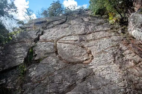
The Azorejo Sandstones, the angular unconformity, the Armorican Quartzite, ripples and a scree.
See the trail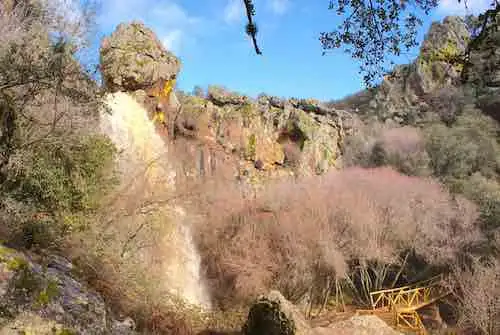
The Pusa Slates, the quartzites within the sandstones and the Chorrera syncline.
See the trail
Ripples in the rock and a scree made by frost, on the way to the highest point of the Montes de Toledo.
See the trail↑↓ to move · Enter to open · Esc to close


