
Lower Palaeolithic
By the water
Camps on the river terraces. So much worked stone turned up in Porzuna that there must have been a workshop there.4
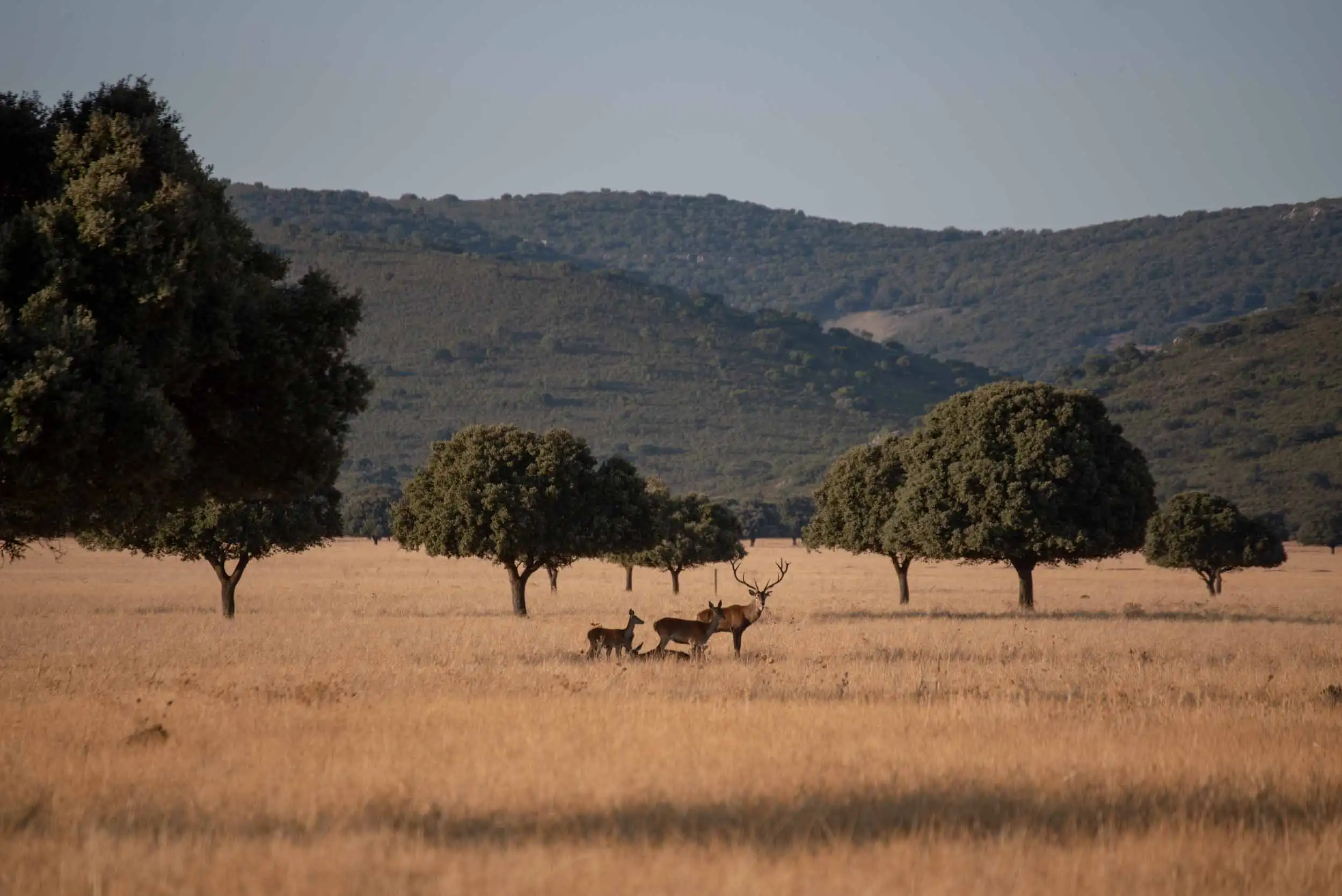
Cabañeros National Park
How a mountain range that belonged to a city, then to a few people and almost became a firing range ended up belonging to everyone.
Start at the beginning12 chapters with drawings · 12 more minutes if you open the full texts
1In a few dates
From the Palaeolithic to thirty years of the national park, in fourteen dates. Scroll down slowly: the map changes hands with each one.
Current boundary of the park (OpenStreetMap). The pieces, the roads and the raña are a sketch. © OpenStreetMap contributors (ODbL).
Palaeolithic
First known settlers of the Montes de Toledo, on the river terraces.
Bronze Age
Fortified settlements on the tops of the hills, around the plain of Alcoba and Porzuna.
Roman era
Roads between Toledo, Mérida and Córdoba that largely follow the line of the Cañada Real Segoviana.
1246
Ferdinand III sells the Montes to the city of Toledo for 45,000 maravedíes. Almost six centuries of Toledan rule begin.
1829
The Montes separate from Toledo and are divided into 16 municipalities.
1860
The «dehesas» are auctioned and pass into private hands.
1941
The purchase of seven estates, forming the great latifundio called «Cabañeros», is completed.
The 1960s
6,000 hectares of the central raña are ploughed and the Torre de Abraham reservoir is built.
The 1980s
The plan for an Air Force firing range comes to light and popular mobilisation stops it.
1988
The regional government of Castilla-La Mancha declares Cabañeros a natural park (11 July).
1995
The Cortes declare it a national park (Law 33/1995, of 20 November).
2005
The park grows with 1,837 hectares of public woodland from Los Navalucillos, to the present 40,856.
2023
With the purchases of El Chorrito and Robledo de los Charcos, 63.1 % of the park is now publicly owned.
2025
The national park turns 30 (20 November).
2Prehistory
The first inhabitants camped by the rivers. In the Bronze Age they moved up to the hills and used the rock crests as walls.1
In the Bronze Age they built their villages on hilltops and used the quartzite crests as walls; they closed the gaps with masonry and rammed earth.2 There are several around the plain of Alcoba and Porzuna, one of them inside the park.

Shepherds and charcoal burners went on living in similar huts until the mid-20th century.3 They gave their name to the place and, later, to the park.
Lower Palaeolithic
Camps on the river terraces. So much worked stone turned up in Porzuna that there must have been a workshop there.4
Middle Palaeolithic
Around the park: Pueblonuevo del Bullaque, Porzuna and Horcajo de los Montes.5
Bronze Age
Fortified villages to keep watch over the passes of the Montes. The remains of one are on top of the Plaza de los Moros.
The routeHuman presence in the Montes de Toledo is very ancient. The first known settlements date from the Lower Palaeolithic: groups that chose river terraces and alluvial fans, close to water. At Las Tiñosillas and Las Casas del Río, in Porzuna, so much worked stone material has turned up (hand axes, cleavers, scrapers) that a workshop is thought to have been there. From the Middle Palaeolithic there are three sites around the park, in Pueblonuevo del Bullaque, Porzuna and Horcajo de los Montes.
In the Bronze Age people climbed up to the hills. They built fortified settlements using the quartzite crests as walls and filling the gaps with rubble masonry and rammed earth. The plain of Alcoba and Porzuna is ringed by these hill-forts, some inside the park, surely to watch over the pass through the Montes. The piles of stones at the top of the Plaza de los Moros, at Horcajo, are the remains of one of them.
Even then people lived in huts, similar to those that shepherds and charcoal burners went on using until the mid-20th century. The name of the place and of the park comes from them: Cabañeros.

3Roads and frontier
The roads from Toledo to Mérida and to Córdoba crossed the Montes, and many were already old when Rome arrived. Centuries later, this was a frontier.
The Romans consolidated the roads between Toledo and Mérida and between Toledo and Córdoba. For much of the way, their course is that of the Cañada Real Segoviana.6
Between the 11th and 13th centuries this was frontier land, almost no man's land. From that time comes the story of Carchena, who with his «golfines» resisted the Christian resettlement.7
Cities and park in their places; the roads, in outline.
The Romans consolidated the roads that crossed the Montes between Toledo and Mérida and between Toledo and Córdoba. Many already existed, and their line largely coincides with today’s drove roads, above all with the Cañada Real Segoviana, which can still be walked on a park route.
With the Visigoths came Christianisation, and with it the power of the Church as a landowner, something that, according to the guide, would end up helping to preserve the Montes. After the Muslim conquest, the region formed part of the Caliphate of Córdoba and later of the taifa of Toledo. Between the 11th and 13th centuries it was frontier land, almost no-man’s-land. From that time comes the story of Carchena, a king who, at the head of the «golfines», a community of Christians, Muslims and Jews, stubbornly opposed Christian resettlement. Remains survive from then or from the Reconquista, such as the Torre de Abraham, which gives its name to the reservoir and to one of the visitor centres.
4Toledo
In 1246 Ferdinand III sold the Montes to the city of Toledo for 45,000 maravedís.8 Toledo governed them until 1829 with ordinances that forbade almost everything.
Toledo told apart the citizen of the city from the people who lived in the Montes, and the monte pardo from the monte bravo and grueso.9
Monte pardo. Rockrose and heather scrub
Monte bravo and grueso. Mature forests of holm oak, cork oak, Portuguese oak and Pyrenean oak
From the bread sown to the lambs, the cheese, the wool or the swarms: a twelfth of everything taken went to the city.10
And on top of that: Portazgo of the Marchés pass, a toll for going through; Acogido de ganados, for transhumant livestock.
The history that explains today’s Cabañeros begins in 1243, when the Church exchanged the Montes with King Ferdinand III. Three years later, in 1246, the king sold them to the city of Toledo for 45,000 maravedíes. Hence the name: Montes de Toledo.
For almost six centuries, until 1829, the city governed them with very strict ordinances. The people of Toledo could take timber, firewood and charcoal for their own use, put in some livestock and keep beehives, but could not plough or cultivate. The inhabitants of the few villages of the Montes, who owned nothing, could only clear patches to sow in the «monte pardo» (rockrose and heath scrub) and then abandon them; they could not cut in the «monte bravo» or the «monte grueso», the mature woods of holm oak, cork oak, Portuguese oak and Pyrenean oak. And of everything they produced, from bread to lambs, cheese, wool or swarms of bees, they paid Toledo a twelfth: the dozavo.
To that were added other taxes, such as the toll at the Marchés pass, for passing through, or the «acogido de ganados», which taxed transhumance. It was an unfair system and a source of constant conflict, which also held back the growth of the villages. But, together with the rugged terrain, it is also the reason why these mountains reached the 19th century much better preserved than others.

51829
In 1829 the villages stopped paying the dozavo and the Montes were split into 16 municipalities.11 What was not shared out was divided into dehesas to be sold.
Each inhabited place kept its own municipality. The rañas, the best land for sowing, were largely ploughed up, and the rest was divided into cuarteles or dehesas to be sold.12
Even today, the mark is strong on the rañas near the villages, weaker on the distant ones and minimal on the high sierras, where the ordinances allowed neither clearing nor grazing.13
Raña near the village. Centuries of ploughing, clearing and grazing. Hardly any trees are left.
Distant raña. Pasture and scattered holm oaks, with more woodland the further away you go.
The high sierra. The forests held out. All that remains are stumps, paths and charcoal hearths from the charcoal burning of the early 20th century.
At the end of the 18th century, with an air of Enlightenment, the villages of the Montes began to ask for their separation. In the Manifesto of 1820 they rejected before the Cortes their vassalage to Toledo, and in 1821 a memorial by Francisco Martínez Robles described their inhabitants as «weighed down by bad administration». Between 1823 and 1837 seigniorial rights were abolished.
In 1829 the Montes were freed from the ordinances and from the dozavo and were divided into 16 municipalities, one for each inhabited place. Alongside the villages, land was shared out among the villagers to cultivate, and since the best land for farming was the rañas, much of it was ploughed. The rest was divided into «cuarteles» or «dehesas» to be sold.
Before the sale, until 1860, those dehesas were in the hands of the city’s creditors, who exploited them to recover their debts, now without the brake of the ordinances. Clearing by fire on the raña was left behind, scrub was thinned to make pasture, charcoal burning soared and the first timber was taken from the woods of the mountains. In 1859 the ten dehesas of southern Cabañeros were dominated by rockrose and heath.

It can still be seen today: the human mark is strong on the rañas near the villages, weaker on the distant ones and minimal on the tops of the mountains, where the ordinances did not allow clearing or grazing and the woods have survived. Even so, in those woods there remain old stumps, paths and charcoal clamps from the early 20th century.
6Hunting estates
The dehesas went to auction in 1860 and gradually fell into a few hands. The last purchase, in 1941, joined seven estates into one: Cabañeros.14
25,600 people lived in the Montes with 131,500 hectares to make a living. Right next to them, another 183,750 hectares, split into 112 estates, could not even be set foot on.15
Each dot, 200 people. The rectangles, to scale.
In 1860 the dehesas were auctioned. Already in those first sales concentration began: the successive purchase of seven properties, which was completed in 1941, gave rise to the great latifundio called «Cabañeros», whose perimeter basically coincides with what would later be the natural park.
The segregation left two worlds: the villages’ lands and an immense area of estates bought by the upper bourgeoisie, almost all resident in Madrid, where traditional uses came to an end and access was closed. In 1900, 25,600 people lived in the Montes with 131,500 hectares to make a living from, while another 183,750 hectares, spread over 112 estates, were not even accessible. Until the Civil War the population grew and the available land did not, and social conflict was strong. Afterwards, under autarky, the estates gave work for almost fifteen years to shepherds, goatherds, woodcutters and charcoal burners.
From the 1950s depopulation arrived: between 1960 and 1965 the region lost 1,300 inhabitants a year. And from the 1980s, woodland could be worth up to four times as much as farmland, because it served for hunting. Hunting became the great use of these estates.
7Agrarian reform
Cabañeros was one of the estates chosen by the Instituto Nacional de Colonización. In the early sixties the woodland was ripped out from 6,000 hectares of the central raña.19
The reports of 1954 proposed clearing 6,000 hectares of the central raña. It was done in the early sixties, in two years of removing scrub and trees.20
hectares cleared
In those years the Torre de Abraham reservoir was built and more than 7,000 hectares of the surrounding land were put under irrigation.21
At the end of 1947 the National Institute of Colonisation began to study the expropriation of estates in the Montes de Toledo, and Cabañeros, because of its size, was one of those chosen. The reports of 1954 proposed ploughing 6,000 hectares of the central raña, and at the start of the 1960s it was done: two years of clearing scrub and trees.
In those same years the Torre de Abraham reservoir was built in the north-east, and more than 7,000 hectares of the surrounding area were put under irrigation.

8Firing range
In the early eighties it came out that the Air Force wanted a firing range in Cabañeros. Local people and environmentalists protested so much that the project ended up in a drawer.
Hardly anyone knew about the natural values of Cabañeros back then; at most its raña, which looked like the African plains.22
At the beginning of the 1980s the plan came to light to install a firing range for the Air Force in Cabañeros. The sources do not agree on the exact year: the park’s own guide speaks of 1981 in one chapter and of 1983 in another, and the park website places the start of the mobilisation in June 1982. What all of them do tell is that the controversy reached the local, national and international press, and that the opposition of the villagers and of environmental groups was so intense that the project did not go ahead.
Curiously, almost nobody knew the natural values of Cabañeros at the time. As the guide says, at most its great raña landscape, which recalled the African plains.
On 3 June 1987, the government of Castilla-La Mancha ordered the start of the procedure to protect it, and on 11 July 1988 it declared it a natural park, with 26,615 hectares. The idea of the firing range was abandoned.
9National park
Natural park in 1988, national park in 1995 and a little bigger in 2005. In twenty years, what is more, the cinereous vulture went from 82 to 204 pairs.26
From the 26,615 hectares of the natural park it went to 39,019 with the national park, and in 2005 another 1,837 of public woodland from Los Navalucillos were added.27
Squares to scale by area.
The cinereous vulture colony of Cabañeros is one of the largest in the world.28
82204 pairs
Between 1999 and 2001 the Organismo Autónomo Parques Nacionales bought four estates, and public land went from 28.7 % to 55.2 % of the park.29
In January 1993 the regional government asked for Cabañeros to be a national park, as an example of the systems tied to Mediterranean woodland. In March 1995 it approved the natural resources management plan of Cabañeros-Rocigalgo, which concluded that it had to be protected in this way, and in April the Council of Ministers sent the draft law to the Cortes. Law 33/1995, of 20 November, declared Cabañeros National Park, with 39,019 hectares.
The law had one particular feature: after a ruling of the Constitutional Court in June 1995, management was entrusted to a joint commission of the State and the autonomous community, something the other parks did not have. In 2004 another ruling established that management should be the responsibility of the autonomous communities.
Since then the park has kept growing and changing. In 2005 it was joined by 1,837 hectares of public woodland from Los Navalucillos, up to today’s 40,856. Between 1999 and 2001 the Organismo Autónomo Parques Nacionales bought four estates, and public land went from 28.7 % to 55.2 % of the park. And the Cinereous Vulture colony, one of the largest in the world, went from 82 pairs in 1995 to 204 in 2015, according to the park newsletter of that year.
10Recent years
The park was declared on estates that were almost all private, and the State is buying them up. In 2023 public land reached 63.1 %.30
After the purchases of 2021 and 2023, 63.1 % of the park is public.31
63.1 % public
Reaching agreement with the private estates is, according to the park itself, one of its great unfinished challenges.
2023
1,568 ha
Between Horcajo and Alcoba, with cinereous vulture nests and peat-bog heathland33
Seven people have been in charge of the park.35
2009
A fire burned some 370 hectares. «When I saw the column of smoke rising I thought it was the end of the Park», Ángel Gómez Manzaneque recalled.36
2025
On 24 April Alcoba opened the «Lucha por Cabañeros» (Fight for Cabañeros) promenade and a monument to those who stopped the firing range.37
2025
The national park turned 30 on 20 November. 1,384 people took part in the month of activities.38
2025
More than 14 million euros: watchtowers, a forest fire truck, the lynx and the Anchurones farmhouse, restored with its Arab tiles.39
More and more public land. The national park was declared over estates that were almost all private, and the State has been buying. After the purchases of 1999 to 2001 came those of the Valle de Candilejos (706 ha, in 2021), El Chorrito (1,568 ha, in 2023, between Horcajo and Alcoba, with Cinereous Vulture nests and peat-bog heathland) and Robledo de los Charcos (706 ha, in 2023, in Navas de Estena, with hollies, birches and ash trees), which links the Valle de Candilejos with Piedras Picadas. In three years public land went from 55 % to 63.1 %: 55.2 % belonging to the Organismo Autónomo Parques Nacionales, 7.4 % to public-utility woodlands and 0.4 % to the regional government. The rest is still private, and the management agreement with those estates is, according to the park itself, one of its great pending challenges.
Fires and wounds that close. The fire of 2009 was, according to Ángel Gómez Manzaneque, the worst moment of his time: «when I saw the column of smoke rising I thought the Park was finished». It ended up at about 370 hectares. The same director, on retiring, was glad to see areas that used to be pine plantation turning into Pyrenean oak and Portuguese oak woods.
Those who have run it. Seven people have headed the park: José Jiménez García-Herrera (1988–2006), Manuel Carrasco Redondo (2006–2013), Antonio Ruiz Serrano (2013–2014), Carlos Rodríguez Vigal (2014–2018), Ángel Gómez Manzaneque (2018–2023), María Jesús Sánchez Soler (2023–2025) and Carolina Sánchez-Molero Olivares, director since February 2026. Antonio Salinas, who chaired the Governing Board of the natural park (1988–1995) and the Board of Trustees of the national park (1996–2011), died on 26 July 2025, aged 76.
The memory of the struggle. On 24 April 2025 Alcoba opened the «Lucha por Cabañeros» promenade and a monolith in honour of those who stopped the firing range, with José Salgado, mayor at the time, and the parish priest Urbano Patón among those present. That November the national park turned 30, with an event at the Horcajo visitor centre on the 20th and a month of activities in which 1,384 people took part.
Recent works. In 2025 alone more than 14 million euros were invested in the park: two fire lookout towers, a forestry truck, the restoration of estates, projects for the lynx and the refurbishment of the Anchurones farmhouse, one of the best-known rural buildings in the park, which has been restored with its Arab roof tiles and its stone and is now used by the park administration.
All this comes from the «Desde el parque» newsletters of 2023 to 2026 (all the newsletters) (in Spanish).
11Trades
Charcoal, livestock, a little cereal, honey and cork. That is what the people of the Montes lived on for centuries, in huts that are now circles of stone.
Holm oak and heather wood, from the raña and the sierra, turned into charcoal. The screes were the chosen spot for the charcoal kilns.40
Today. Charcoal hearths from the early 20th century are still found in the forests.
A little cereal to eat: on the cleared plots of the monte pardo and, from 1829, on the land shared out next to the villages.
Beehives were one of the few things Toledo's ordinances allowed.
Today. It goes on, on the park's public land too.
The bark of the cork oak is cork, and it is taken off without cutting the tree down.
Today. Only on the park's private estates.
The activities that kept the people of the Montes going for centuries were charcoal burning, herding and subsistence farming, together with beekeeping and cork stripping from the cork oaks. Today cork stripping is only practised on the park’s private estates; beekeeping also on public land.
Of the huts hardly any remain except the restored ones, but in many places you can still see «hut floors», the stone circles that mark where small settlements stood. To get to know this way of life up close:
12Flavours
What is eaten here comes from the same history: the olive oil, the honey from the hives Toledo allowed and the game of a century of hunting estates.
Protected designation of origin Aceite Montes de Toledo, made only from Cornicabra olives.45
The direct heir of the beehives the ordinances allowed.
What a century of hunting estates left on the plate.
An artisan cheese dairy in Los Navalucillos, a member of the European Charter for Sustainable Tourism.46
The local products are the same ones that have fed the Montes for centuries. The oil has a protected designation of origin, Aceite Montes de Toledo, made only from the cornicabra olive. There is honey, a direct inheritance from the beehives that the ordinances allowed, and game meat, a consequence of a century of hunting estates. Among the businesses that belong to the park’s European Charter for Sustainable Tourism there is an artisan cheese dairy in Los Navalucillos and agri-food estates that can be visited; the park lists them in its information document.

the quartzites, the sea of 400 million years ago and the origin of the raña.

trilobites, cruzianas and the giant marine worm of the Boquerón.

↑↓ to move · Enter to open · Esc to close


