
Skip to content
Cabañeros National Park
Cabañeros
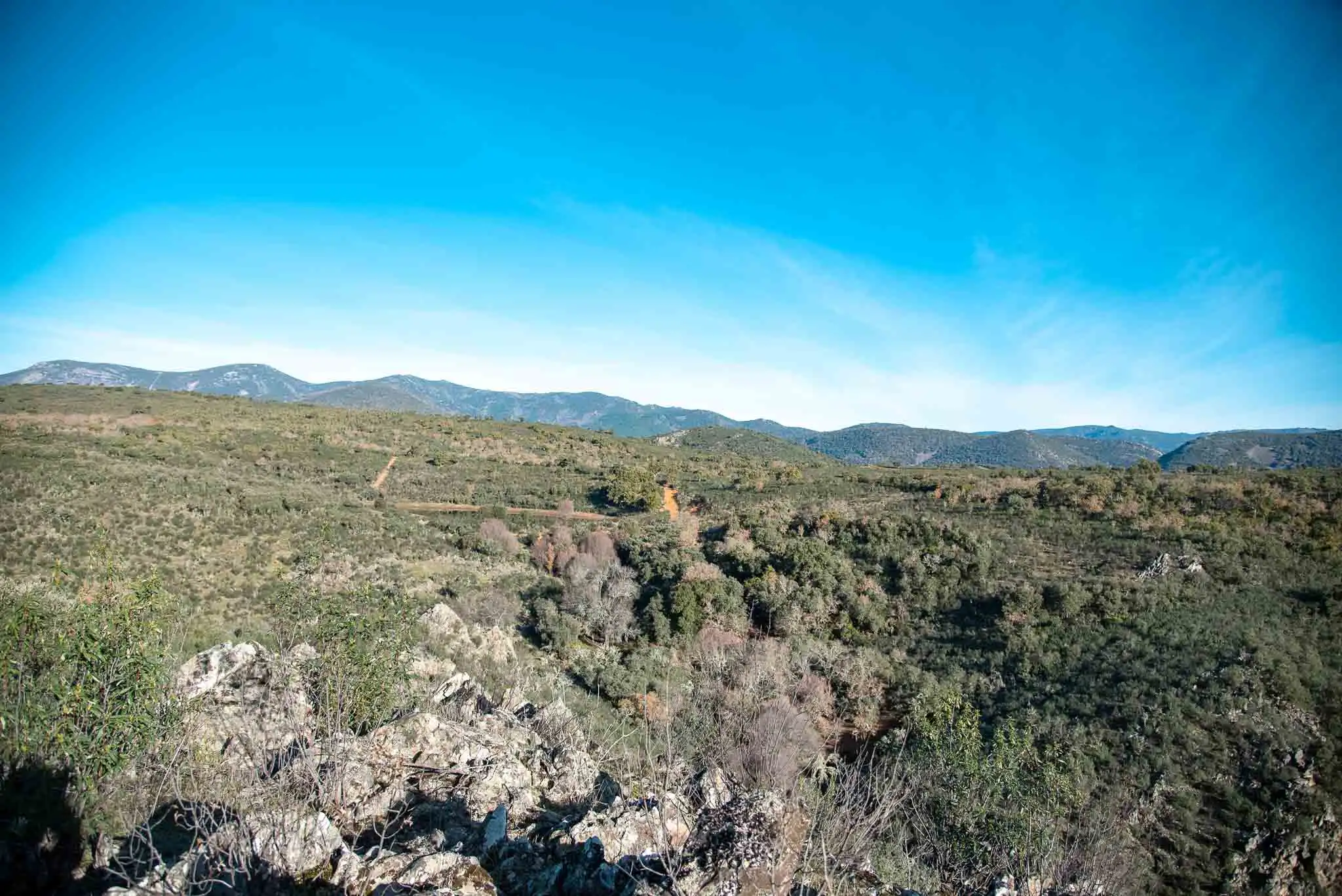
Gargantilla: quartzite mountains covered in Mediterranean scrub

Cabañeros National Park

Walking trails

The park's official trails and one from its surroundings: waterfalls, rañas, riverside woods, drove roads and the summit of the Montes de Toledo.

  • 15 trails
  • 6 starting points
  • 12 self-guided

The trails, one by one

Ordered from south to north, by starting point. Choose by difficulty or by the time you have; the map shows where each one is.

  1. Horcajo de los MontesSelf-guided

    Plaza de los Moros

    It climbs a shady slope of Mediterranean scrub to the Umbría peak (812 m), with remains of a Bronze Age settlement and views as far as the Villuercas.

    Distance
    3.8 km
    Climb
    150 m
    Duration
    1 h 30 min
    Difficulty
    Low
    • RouteCircular
    • StartCar park beside the CM-4106, on the way out of Horcajo towards Alcoba
    • AccessSelf-guided. Path marked with posts.
    • Bear in mindOn foot from the village it takes about 3 h 30 min.
  2. Horcajo de los MontesSelf-guidedBike

    Sierra de Castellar de los Bueyes

    A track half way up the slope between cork oaks and strawberry trees, with the olive groves of the Rubial valley below and Cinereous Vultures in the sky.

    Distance
    5 km
    Climb
    85 m
    Duration
    2 h 15 min
    Difficulty
    Low
    • RouteLinear, there and back
    • StartThe same car park as the Plaza de los Moros, at km 54 of the CM-4106
    • AccessSelf-guided, on foot or by mountain bike.
  3. Horcajo de los MontesSelf-guided

    La Chorrera

    A narrow path through riverside woodland with hollies, birches and ferns to a 15-metre waterfall.

    Distance
    2.5 km
    Climb
    21 m
    Duration
    2 h
    Difficulty
    Low
    • RouteLinear, there and back
    • StartPicnic area at the end of the Chorrera track, about 4 km from the village
    • AccessSelf-guided route, outside the national park, suitable for children from 4 or 5 years old.
  4. Pueblonuevo del BullaqueSelf-guidedBike

    Colada de Navalrincón

    An old livestock track, almost flat, across the Bullaque floodplain and the edge of the raña, with red deer at dawn and dusk.

    Distance
    9.5 km one way
    Climb
    50 m
    Duration
    3 h one way
    Difficulty
    Low
    • RouteLinear, between two visitor centres
    • StartTorre de Abraham Visitor Centre (or Casa Palillos, at the other end)
    • AccessSelf-guided, on foot or by mountain bike.
    • Bear in mindIn winter some stretches get waterlogged. If nobody can pick you up at Casa Palillos, the way back is on foot.
  5. Road from Horcajo to RetuertaSelf-guided

    La Viñuela

    It goes down to a centuries-old Pyrenean oak wood with protected peat bogs and returns among Portuguese oaks, with vultures and imperial eagles over the valley.

    Distance
    13 km
    Climb
    150 m
    Duration
    3 h 15 min
    Difficulty
    Medium
    • RouteSemicircular
    • StartCar park at km 17 of the road from Horcajo to Retuerta
    • AccessSelf-guided. Signposted path.
    • Bear in mindIn summer, go very early: it is long and hot.
  6. Road from Horcajo to RetuertaSelf-guided

    Cañada Real Segoviana

    It climbs to the road of the transhumant flocks and follows it among old cork oaks to El Abuelo, one of several centuries.

    Distance
    4.6 km
    Climb
    150 m
    Duration
    1 h 15 min
    Difficulty
    Medium
    • RouteLinear, there and back
    • StartThe same car park as La Viñuela, at km 80.5 of the CM-4017
    • AccessSelf-guided. Self-guided leaflet from the park.
    • MapIts track is not mapped: the map marks the start.
  7. GargantillaGuided

    Oak–cork oak woods

    The short version of the Cork oak valley trail: a loop through cork oaks in the west of the estate that ends in an oak wood on the valley floor.

    Distance
    5 km
    Climb
    100 m
    Duration
    2 h 30 min
    Difficulty
    Low
    • RouteCircular
    • StartYou meet the guide at the estate gate, along a dirt track of about 4 km from km 37 of the CM-4157; from there you continue by car
    • AccessWith advance booking and a guide. The gate closes 15 minutes after the set time.
    • Good to knowThis is the afternoon trail, except in July and August. The official track is a loop plus a branch along the valley (dotted on the map): the park does not say at which point the walk begins.
  8. GargantillaGuided

    Cork oak valley

    The big loop around the estate from the Gargantilla house: cork oak woods, an oak wood on the valley floor and two ponds where you can observe amphibians.

    Distance
    10 km
    Climb
    150 m
    Duration
    4 h
    Difficulty
    Low
    • RouteCircular
    • StartYou meet the guide at the estate gate, along a dirt track of about 4 km from km 37 of the CM-4157; from there you continue by car
    • AccessWith advance booking and a guide. The gate closes 15 minutes after the set time.
    • Good to knowIt starts and ends at the Gargantilla house. It is one of the two long morning trails: the guide chooses between this one and Valhondo depending on the weather.
  9. GargantillaGuided

    Valhondo

    Views of the mountains and a descent to the banks of the Estena river and the Valhondo stream, with a stretch among rocks.

    Distance
    6.5 km
    Climb
    300 m
    Duration
    4 h
    Difficulty
    Medium
    • RouteCircular
    • StartYou meet the guide at the estate gate, along a dirt track of about 4 km from km 37 of the CM-4157; from there you continue by car
    • AccessWith advance booking and a guide. The gate closes 15 minutes after the set time.
    • Good to knowIt starts and ends at the Gargantilla house. It is one of the two long morning trails: the guide chooses between this one and the Cork oak valley depending on the weather.
  10. Navas de EstenaSelf-guided or guided

    Boquerón del Estena

    It follows the Estena river among quartzite towers, trilobite tracks and the fossil of the largest and oldest marine worm in the world.

    Distance
    6.5 km
    Climb
    20 m
    Duration
    2 h 30 min
    Difficulty
    Low
    • RouteLinear, there and back
    • StartOpen ground past the village, towards the campsite
    • AccessWith or without a guide. Guided visits must be booked.
  11. Navas de EstenaSelf-guided

    Camino del Acebo y las Fuentes

    Flat, beside the Estena: a walkway with a viewpoint over the Boquerón, the Fuente Fría and the Fuente de las Chinas, with its peat bog and its trilobites.

    Distance
    3 km from the recreation area (7 from the village)
    Climb
    10 m
    Duration
    1 h 15 min
    Difficulty
    Low
    • RouteLinear, there and back
    • StartThe village or the car park of the Tabla del Acebo recreation area, 2 km away
    • AccessSelf-guided. The walkway at the start is accessible.
  12. Los NavalucillosSelf-guided or guided

    El Chorro

    A 18-metre waterfall after riverside woodland, peat bogs, a vulture crag and an old shepherds' shelter.

    Distance
    4.2 km one way
    Climb
    200 m
    Duration
    3 h
    Difficulty
    Medium
    • RouteLinear, there and back
    • StartLas Becerras information hut, by the track at km 16 of the CM-4155
    • AccessWith or without a guide. If you go with a guide, they wait at the hut for 15 minutes.
  13. Los NavalucillosSelf-guided or guided

    Chorrera Chica

    It continues beyond El Chorro, along quartzite ledges with trace fossils, to another 18-metre waterfall.

    Distance
    6.1 km one way
    Climb
    300 m
    Duration
    4 h 30 min
    Difficulty
    Medium
    • RouteLinear, there and back
    • StartLas Becerras information hut, by the track at km 16 of the CM-4155
    • AccessWith or without a guide. If you go with a guide, they wait at the hut for 15 minutes.
    • Bear in mindIf you suffer from vertigo, better not to cross the ledges.
  14. Los NavalucillosSelf-guided or guided

    Rocigalgo massif

    It climbs to the summit of the Montes de Toledo, at 1448 metres, with the whole park in view. A long route: you need to be well prepared.

    Distance
    9.6 km to the summit
    Climb
    700 m
    Duration
    8 h
    Difficulty
    Medium
    • RouteTo the summit and back by the track
    • StartLas Becerras information hut, by the track at km 16 of the CM-4155
    • AccessWith or without a guide. If you go with a guide, they wait at the hut for 15 minutes.
    • Bear in mindTake food, water and sun protection or warm clothes, depending on the weather.
  15. Los NavalucillosSelf-guided

    La Encina

    A short walk through the Arañosa valley to a holm oak hundreds of years old, with the summits of the Montes de Toledo all around.

    Distance
    2 km
    Climb
    75 m
    Duration
    1 h
    Difficulty
    Low
    • RouteLinear, there and back
    • StartLas Becerras information hut, by the track at km 16 of the CM-4155
    • AccessSelf-guided.
    • MapIts track is not mapped: the map marks the start.
Horcajo de los MontesNavas de EstenaRetuerta del BullaqueAlcobaPueblonuevo del BullaqueSanta QuiteriaTowards Los Navalucillos1Plaza de los Moros2Sierra de Castellar de los Bueyes3La Chorrera4Colada de Navalrincón5–6Road from Horcajo to Retuerta2 trails7–9Gargantilla3 trailsGargantilla3 trails10Boquerón del EstenaBoquerón del Estena11Camino del Acebo y las Fuentes12–15Los Navalucillos4 trails
Map of the trails and their starting pointsTracks from each route’s map; Cork oak valley and Oak–cork oak woods, from the ministry’s official track; the Acebo, Castellar de los Bueyes and Navalrincón, from OpenStreetMap (ODbL), checked against the park’s map and official information. Grey lines: access by car. Park boundary, rivers and villages: © OpenStreetMap contributors (ODbL). Drag to move the map.

The 16 official routes

This is how the park numbers them. The guided ones are free and must be booked; two can be done by mountain bike, and bicycles are not allowed on the rest.

RouteHowLengthDurationDifficulty
1Torre de Abraham pathTorre de AbrahamSelf-guidedAccessible0.9 km, circular45 minLow
2Plaza de los MorosHorcajo de los MontesSelf-guided3.8 km, circular1 h 30 min (3 h 30 min from the village)Medium–low
3Boquerón del EstenaNavas de EstenaSelf-guided or guided6.5 km there and back from the car park (10 km from the village)2 h 30 min there and back from the car park (3 h 30 min from the village)Low
4El Chorro, Chorrera Chica and RocigalgoLos NavalucillosSelf-guided or guidedOne way: 4.2 km to El Chorro, 6.1 km to the Chorrera Chica and 9.6 km to the RocigalgoOne way: 2 h to El Chorro, 2 h 45 min to the Chorrera Chica and 4 h to the RocigalgoMedium
5Rocigalgo massifLos NavalucillosSelf-guided22.4 km there and back, or 19 km circular linking up with the El Chorro route6-7 hHigh
6La ViñuelaRoad from Horcajo to RetuertaSelf-guided13 km, semicircular3-3 h 30 minMedium
7Cañada Real Segoviana-Los AlcornoquesRoad from Horcajo to RetuertaSelf-guided4.6 km there and back1 h 15 min there and backMedium
8Colada de NavalrincónPueblonuevo del BullaqueSelf-guidedBike9.5 km (one way only)3 h (one way only)Low
9Casa Palillos botanical pathCasa PalillosSelf-guidedAccessible0.6 km, circular30 minLow
10Casa Palillos ethnographic pathCasa PalillosSelf-guidedAccessible0.8 km, circular30 minLow
11Sierra de Castellar de los BueyesHorcajo de los MontesSelf-guidedBike5 km there and back2 h 15 min there and back (4 h 30 min circular from the village)Low
12Oak–cork oak woodsGargantillaGuided5 km, circular2 h 30 minLow
13ValhondoGargantillaGuided6.5 km, circular4 hMedium–low
14Cork oak valleyGargantillaGuided10 km, circular4 hLow
15Camino del Acebo y las FuentesNavas de EstenaSelf-guidedAccessible3 km there and back from the car park (7 km from the village)1 h 15 min there and back from the car park (3 h from the village)Low
16La EncinaLos NavalucillosSelf-guided2 km there and back1 h there and backLow

Bookings for the guided routes: the park's administrative centre (926 783 297 / 926 783 456) or the National Parks Booking Centre. Data: park information (MITECO, 2025).

Before you set out

What it is worth knowing for any of the trails.

  • Footwear

    Hiking boots or, at the very least, trainers. There are crossings over wet stones and muddy stretches.

  • Water and food

    Bring water from home: there is nowhere to buy it along the way. On the long routes, bring food too.

  • Sun and warm clothes

    In summer, a cap, sunglasses and sun cream, and it is better to start early. In winter, warm clothes.

  • Wildlife

    According to the park, the first and last hours of light are the best for seeing it. Bring binoculars.

  • Guides and bookings

    On the guided routes, the guide waits 15 minutes. Gargantilla can only be done with a booking. Park information: 926 783 297.