
Skip to content
Cabañeros National Park
Cabañeros
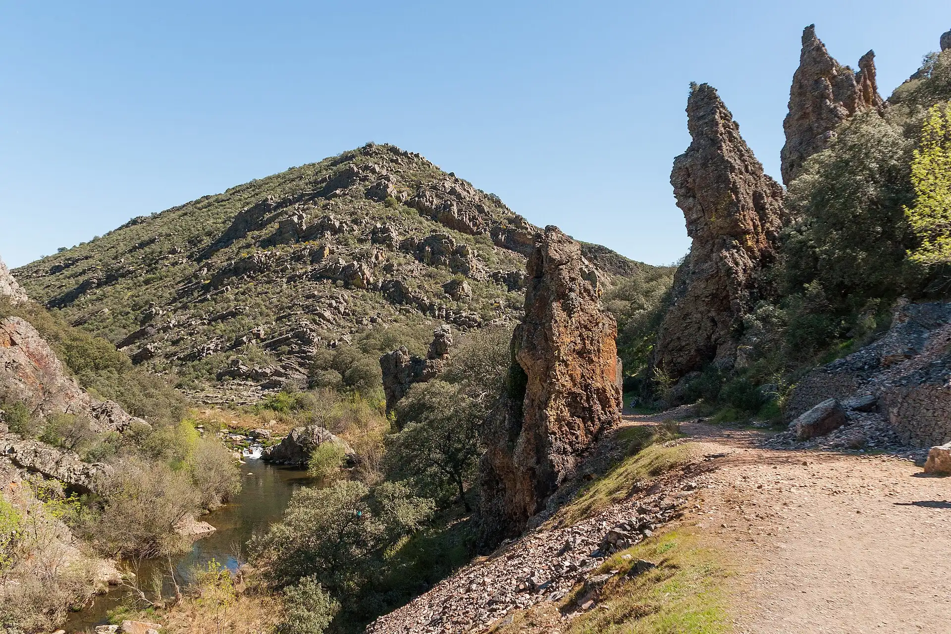
The Boquerón del Estena: the river cuts through quartzite ridges next to Navas de Estena

Villages of the park · Ciudad Real

Navas de Estena

Among meadows and slates from a sea more than 400 million years old, at the entrance to the Boquerón.

  • 269inhabitants (2025)
  • 1 h 50 minfrom Madrid
  • 1 h 20 minfrom Ciudad Real

Photo: Juan Manuel González Morales, CC BY-SA 3.0 es

The village of the Boquerón

Navas de Estena sits among small hills and hollows, the navas that give it its name, shaped on the fossil-bearing slates of the Middle Ordovician. That is, on the floor of a sea that covered this area more than 400 million years ago, and which still shows in the tracks along the Boquerón route.

Just outside the village, the Estena river cuts into one of the most spectacular river gorges in the area. The Boquerón is the best-known route in the park and is classed as a Site of Geological Interest.

What to see

  • Church of Nuestra Señora de la Antigua, famous throughout the region, according to the park guide.
  • The hermitage, on a height from which you can see the Estena river entering the Boquerón.
  • The information point, with its exhibition on banditry, which gave people plenty to talk about in these hills.
  • The Boquerón del Estena and, very close, the Tabla del Acebo track, upriver.

In 2023 the State bought the Robledo de los Charcos estate, 706 hectares of Navas land with hollies, birches and ash trees beside the Arroyo de las Urraleras, joining two public estates of the park, the Valle de Candilejos and Piedras Picadas (history of Cabañeros).

The town council has no tourism website of its own; for festivals and opening hours, it is best to ask at the information point or at its online office.

Gateway to the park

Visitor centres, routes and visits in the National Park that you enter from Navas de Estena.

Festivals

We have not found the festival calendar in an official source. Ask the town council (online office).

Other routes in the municipality

  • Los Reales route (10 km, highly recommended by mountain bike)
  • Track to the Presa de los Reales recreation area
  • Hermitage route

Routes outside the park listed in the official guide, with data from the town councils.

Getting there

  • From Madrid152 km · 1 h 50 min
  • From Toledo78 km · 1 h 05 min
  • From Ciudad Real102 km · 1 h 20 min
  • From Talavera80 km · 1 h 05 min

By car. Distances from OpenStreetMap; times corrected with real journeys and rounded. Approximate. Roads and buses.

Services

  • National Park information point

Source: MITECO-OAPN, General information about Cabañeros National Park (2025).

No petrol station registered in the municipality. The nearest: Retuerta del Bullaque (carretera cm-4017 km. 66.09), 10.4 km as the crow flies; hours Mon–Sun: 08:00-22:30. According to the Ministry's Petrol Station Geoportal.

Town council · official website