Skip to content
Cabañeros National Park
Cabañeros
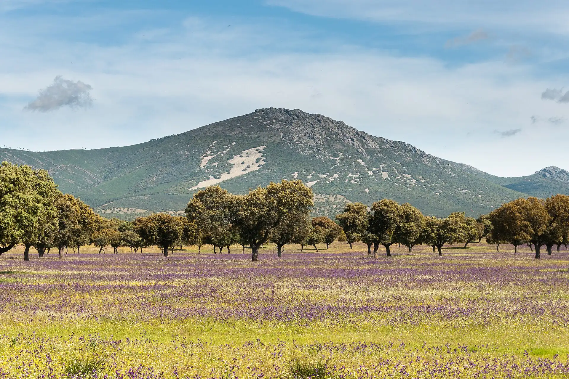
Raña of Retuerta del Bullaque in spring, with scattered holm oaks and a hill of the Montes de Toledo behind

Villages of the park · Ciudad Real

Retuerta del Bullaque

Where the Bullaque turns, between the Retuerta raña and Torre de Abraham.

  • 854inhabitants (2025)
  • 732 mabove sea level
  • 1 h 40 minfrom Madrid
  • 1 h 05 minfrom Ciudad Real

Photo: Juan Manuel González Morales, CC BY-SA 3.0 es

Where the river turns

Retuerta lies at 732 metres, in the upper Bullaque basin. The river goes round the village on the south side in a sharp bend, and its name probably comes from that turn, that retuerta.

It is the municipality of the northern and eastern gateways to the park: on its land are the Torre de Abraham, with its visitor centre and reservoir, and Pueblonuevo del Bullaque, where the park office works.

What to see

  • Parish church of San Bartolomé, from the 17th century.
  • The Castillo de Prim, a historicist-style palace-house commissioned by General Prim.
  • The Torre de Abraham, beside the reservoir of the same name, with a viewpoint offering wide views over the water and the raña of Retuerta. The reservoir fills and empties depending on the year: in February 2026, after the storm, it released water for the first time in thirteen years (the climate of Cabañeros).
  • The El Chorrillo recreation area, on the way out towards Horcajo, in the shade of chestnut trees.
  • The Dehesa del Carrizal winery, one of the two around the park with the Vino de Pago classification, the highest there is.
  • El Zoorama, the municipal wildlife museum, which also gives information about the park. It is temporarily closed for renovation.

Gateway to the park

Visitor centres, routes and visits in the National Park that you enter from Retuerta del Bullaque.

Festivals

We have not found the festival calendar in an official source. Ask the town council (online office).

Other routes in the municipality

  • Cañada Real Segoviana route
  • Robledillo–Bullaque route (12 km, across the raña and the Bullaque ash grove)
  • El Chorrillo route
  • Bullaque River route, between Pueblonuevo and Retuerta

Routes outside the park listed in the official guide, with data from the town councils.

Getting there

  • From Madrid150 km · 1 h 40 min
  • From Toledo74 km · 1 h 00 min
  • From Ciudad Real90 km · 1 h 05 min
  • From Talavera91 km · 1 h 20 min

By car. Distances from OpenStreetMap; times corrected with real journeys and rounded. Approximate. Roads and buses.

Services

  • Petrol station on the CM-4017, km 66 (open Monday to Sunday, from 8:00 to 22:30)

Source: Petrol Station Geoportal, Ministry for the Ecological Transition (consulted 13-10-2026).

Town council · official website